Geospatial Technology: Use of LiDAR in disaster response
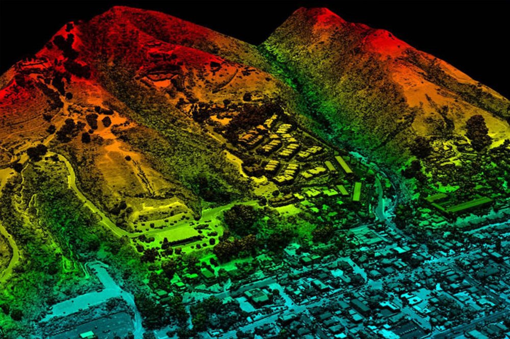
LiDAR can be used to generate detailed maps of topography and retrieve digital elevation data. Use of LiDAR in disaster response is gaining ground since visualization of the point cloud data allows emergency responders to easily identify areas most affected by a calamity.
Generating Detailed Information
LiDAR, which stands for Light Detection and Ranging, is a surveying method that measures distance to a particular target by illuminating the target with pulsed laser light and measuring the reflected pulses with a sensor. Simply put, it is active remote sensing as the system sends a pulse of light and waits for the pulse to return. Among other things, LiDAR can be used to generate detailed maps of topography and retrieve digital elevation data necessary for flood modeling and vulnerability, along with risks analysis.
MIT Lincoln Laboratory is collecting post-disaster LiDAR datasets and applying advanced algorithms to this data to help FEMA (Federal Emergency Management Agency) assess post-disaster damage. Days after Hurricane Harvey hit Houston, Texas, in 2017, heaps of debris was being inspected by the U.S. Army Corps of Engineers (USACE) in Windmill Bluff Lane. Meanwhile, MIT Lincoln Laboratory was collecting 3D Geiger-mode LiDAR data over the area and using advanced algorithms to estimate the total volume of debris there. It was the laboratory’s first demonstration of how LiDAR with new algorithms could be used to quantify the damage after a hurricane. “We want this type of LiDAR and analytics to become established tools for disaster relief,” John Aldridge, a leader of the Humanitarian Assistance and Disaster Relief (HADR) Systems Group at MIT Lincoln Laboratory, was quoted as saying.
More Knowledge Means Better Preparedness
Disasters can lead to severe damage to natural and man-made infrastructure. In the event of a calamity, acquiring highly accurate information becomes crucial to relief work and resilience. The increased availability of LiDAR data is changing the way that agencies prepare for, and respond to, disasters. The ability to extract quality elevation models from LiDAR point clouds decreases the amount of time it takes to get reliable information about on-the-ground conditions during an emergency. Visualization of the LiDAR point cloud allows emergency responders to easily identify areas most affected by the disaster. In some cases, having a 3D view of a situation can provide unique information to help responders.
One of the major benefits of using LiDAR in disaster response is the ability to extract high quality elevation information from the point cloud that can be used to build 3D models. In turn, these models can be used to understand terrain mobility. Further, the ability to obtain building features automatically from the point cloud can be extremely useful in pre and post-disaster response.
It is no surprise then that experts around the globe have been predicting and in some case even advocating the use of LiDAR for disaster response and management.